Camas North Shore Subarea Plan
The purpose of the Camas North Shore Subarea Plan is to empower the City and community to guide future development in a way consistent with the community’s values and to strike a balance between preserving open space and making room for new community members. Following is a condensed summary of the North Shore Subarea Plan.
Introduction, Vision, and Outreach Planning Process
The subarea plan was completed in two phases. Phase 1 focuses on community outreach to create a vision statement that captures how the community wants the area to develop. From August 2019 to September 2020, the City conducted public outreach activities and engaged with stakeholders, community members, and property owners at community events and through online surveys.
Phase 1 Community and Stakeholder Outreach The City of Camas began public outreach efforts in the fall of 2019 with community events hosted at local schools, the Camas Farmers Market, and the Camas Youth Advisory Council.
Community Advisory Committee After a citywide application process, the North Shore CAC was established in December 2021.
The committee advised the City and provided a community perspective before broader community outreach efforts.
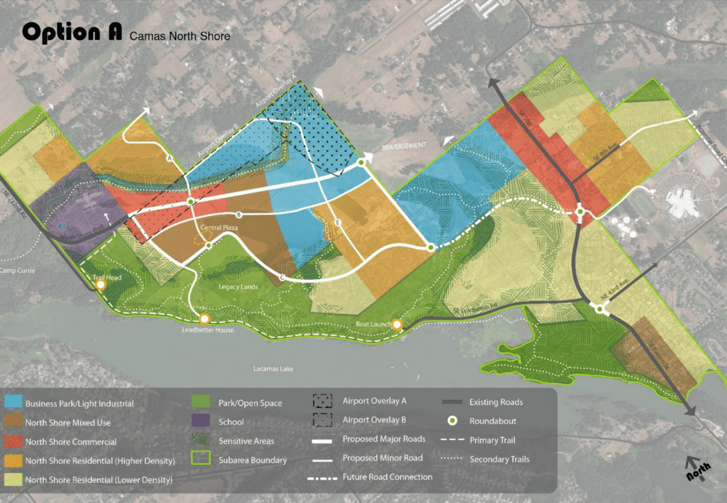
In Phase 2, guidance and input from the community and stakeholders were sought to inform the development of a preferred land use and transportation concept plan and design guidelines and standards for the North Shore.
The City convened a North Shore Steering Committee and a North Shore Community Advisory Committee and conducted broad outreach to the Camas community.
The first virtual open house for Phase 2 took place in February and March 2022 to obtain community feedback on draft land use and transportation options for the North Shore.
Participants in the online open house were prompted to provide feedback on how well the concept met the community’s vision for the North Shore and the design guidelines for the look and feel of future development.
Phase 1
These analyses are summarized below and provided as Appendix B. Existing Conditions The existing conditions analysis identified existing land uses and zoning; parks, trails, and open spaces; critical areas; utility infrastructure and capacity; and the current transportation network and planned improvements.
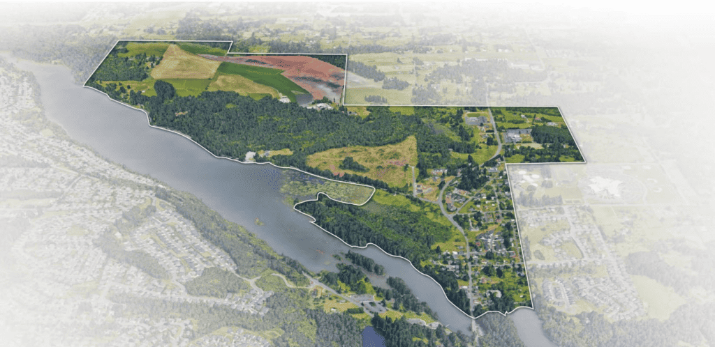
Existing Zoning Portions of the subarea are within shoreline jurisdiction along Lacamas Lake and Round Lake and will be subject to the City’s Shoreline Master Program.
This jurisdiction includes land extending 200 feet in all directions from the ordinary high water mark, floodways, and contiguous floodplain areas landward 200 feet from such floodways, associated wetlands, critical areas with associated buffer areas, river deltas associated with the streams, and lakes and tidal waters that are subject to the provisions of this program.
There are several limitations to development in the subarea, including protected critical areas and the Legacy Lands, which will be preserved for open space and recreation.
Approximately half of subarea contains critical areas, including wetlands, fish and wildlife habitat conservation areas, geologically hazardous areas, critical aquifer recharge areas, and frequently flooded areas.
These areas are protected and regulated by the City’s critical areas ordinance, and development may be limited in these areas.
Critical Areas and Legacy Lands Market Analysis A preliminary market analysis was prepared during Phase 1 to identify opportunities and constraints in the North Shore area and to ensure that the strategies identified in the subarea plan are grounded in market realities.